


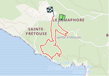
la Ciotat

cousam
User

Length
1.8 km

Max alt
145 m

Uphill gradient
80 m
Km-Effort
2.8 km

Min alt
0 m

Downhill gradient
71 m
Boucle
Yes
Creation date :
2024-02-04 10:36:00.885
Updated on :
2024-02-05 16:25:47.721
1h09
Difficulty : Easy

FREE GPS app for hiking
 SityTrail
IGN / Geographical institutes
SityTrail Plus
The world is yours!
About
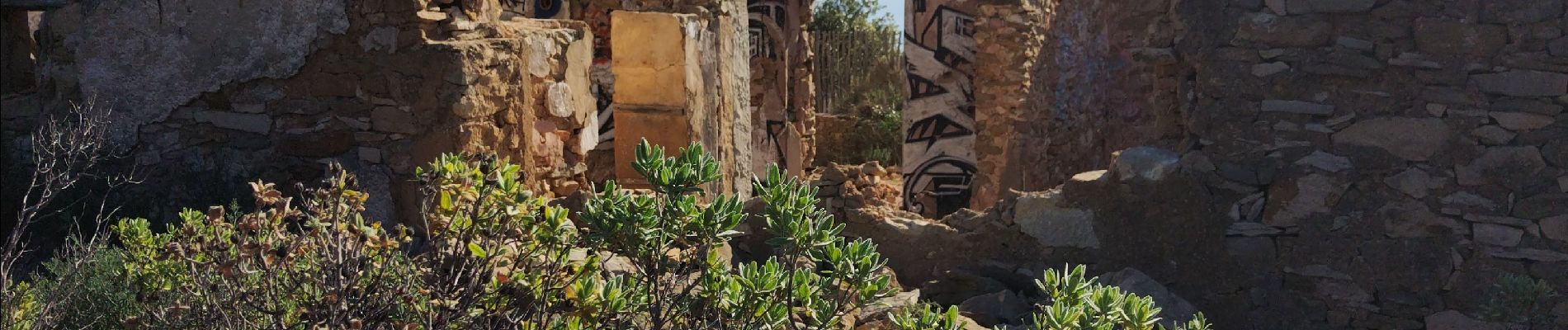
Trail Walking of 1.8 km to be discovered at Provence-Alpes-Côte d'Azur, Bouches-du-Rhône, La Ciotat. This trail is proposed by cousam.
Photos


Positioning
Country:
France
Region :
Provence-Alpes-Côte d'Azur
Department/Province :
Bouches-du-Rhône
Municipality :
La Ciotat
Location:
Unknown
Start:(Dec)
Start:(UTM)
710090 ; 4783275 (31T) N.
Comments